Land legislation cannot be called very simple. The relationships that this Code controls are characterized by a large number of nuances. For example, a very important concept is the cadastral number of a land plot. What it is, how it is made out and why it is received, you will learn further.
Basic concept
The cadastral number of a land plot is a specific numerical code possessed by almost every single part of the land area. It must be assigned during the period of state registration. Please note that the same number is assigned to the site for the entire time of its existence. In some cases, it may be replaced.
The cadastral number of the land plot contains a lot of information: the purpose of this property, its location and actual size of the area, information about the owner.

What is the number for?
This code allows you to carry out certain actions with the ground: buy, sell or give away. Without it, you will not be able to make any transactions even with structures that are located on the specified area. The code makes it possible to alienate the site.

Note that if it is necessary to complete the inheritance procedure, the absence of the presented code cannot prevent this. Naturally, it should be, if you further want to do something with the ground.
What is included in the cadastral number?
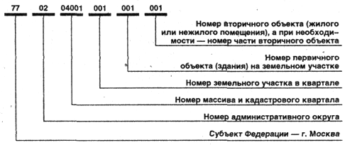
This number implies a large amount of information. The cadastral number of the land plot contains the following data:
- District
- Cadastral district and quarter.
- Directly registered plot of land and information about it.

It should be noted that the presented code has 19 digits, each of which has its own meaning. Please note that the cadastral number of the land (its value cannot be large (200 rubles)) is the same for each object in the specified region. All groups of numbers are delimited by colons.
Thanks to this unique code, you have the opportunity to avoid any disputes regarding manipulations with the site, its boundaries.
How can I get a unique code?

Assignment of a cadastral number can be done quite quickly. You will need to perform just a few actions:
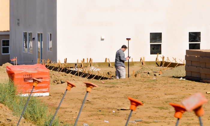
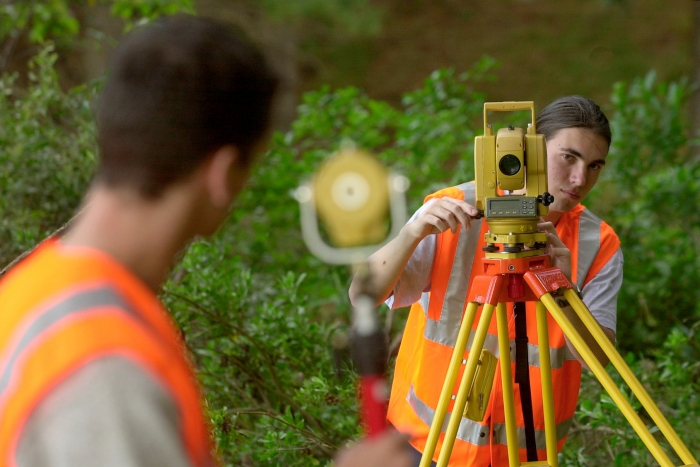
- Obtaining technical documentation. To do this, you should contact the geodetic organization, which will measure your site and give the appropriate paper. Please note that the selected organization must have a license. All documentation should be prepared in triplicate. For papers you should also be given an electronic exchange file.
- The appeal to Rosreestr. For this, the prepared documents and application must be referred to a specialist. Do not forget to capture the electronic exchange file. Naturally, you must also provide a certificate of payment of state duty.
- Obtaining a cadastral number. In Rosreestr all your data must be checked. It will take at least a month. But immediately after the end of the check, you will receive the coveted number. It is prescribed on technical documentation. You should also receive a certificate that the cadastral number was assigned to you.
Please note that after the delivery of the collected documents you need to receive a receipt on their acceptance and writing an application.So you insure yourself against the accidental loss of your papers. In addition, this receipt is presented at the time of receipt of the number. After you have the cadastral passport, right at the office, double-check that all the data in it matches the information in the title documents. This will save you from minor errors, which, however, can significantly interfere with your right to use the territory.
What documents need to be prepared?

If you need to get a cadastral number, you must definitely collect a certain list of papers. In principle, there are few of them. You will need:
- Passport or notarized power of attorney (if your interests will be led by another person).
- Application (you need to write it correctly, however, a sample will be provided to you).
- Boundary plan.
- A document that proves your ownership of the plot. This can be a certificate of land ownership, a lease or an extract from the business book. If you do not have these papers on hand, contact the city archive with a request for a copy.
Please note that only sites that have not been registered with state bodies do not have a number. In order to have the right to dispose of the territory at its discretion, this procedure must be completed.
How and where can I find out the number?
I must say that the code does not always have to be received. Often the buyer buys real estate, not even knowing about its availability. However, sometimes it will have to be recognized. This is not difficult to do.
You can find out the cadastral number of a land plot as follows:
- Take a look at the technical documentation. It is in the cadastral passport that the code of your site should be registered. If you do not have it, then you can use another way.
- Request information from the state cadastre over the Internet. To do this, go to the registration service website. There you will find the item “Public Cadastral Map”. In this menu you can find the site at your address. After you find the desired area, click on the arrow or question mark located on it. After that, you will see all the information you are interested in.
- Personally contact the Federal Registration Service.
- In telephone mode. In order to find out information, you will have to provide your personal data. This may not be the safest way.
Naturally, on this map you can also find out the addresses of Rosreestr representative offices that service your territory. You can also communicate with the specialists of your department online. In this case, the answer to your request may come by letter by mail or in the form of an electronic file.
As you can see, the search for the cadastral number of the land is not difficult.
What can you find out thanks to the number?

As you already understood, in any case you will need to contact the Rosreestr. The cadastral number of the land is a special code that is not so difficult to find. However, thanks to him, you can find out a lot of additional data:
- The category of land and the type of its permitted use. This will help you decide whether to buy the specified site. The fact is that in the territory intended for gardening, it is rarely possible to build a residential building.
- The date of updating the attributes and boundaries of the site, if any. However, the information can be very detailed.
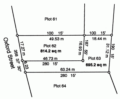
- Land area (length and width in meters).
- Form of ownership, its status.
- The exact address of the site, as well as information about the presence of any structures on it.
- Cadastral value. It is much lower than the market.
- Date and time of cadastral registration.
- In addition, you have the right to find out who owns the selected site. To do this, you just need to contact the EGPR department with a request. Basically, this is all done over the Internet. However, for receiving such information it will be necessary to pay a state fee.Difficulties may arise in determining the owner of the garden, as the data may be outdated and unreliable.
If you are planning to acquire land, then this information will help you make a good choice.
Can I change the code?
I must say that in some cases, you can make a change in the cadastral number of the land. Such a procedure can be done if:
- The plot was divided between the owners.
- One territory was merged with another.
- The plot became part of another administrative-territorial unit.
This list cannot be called established, since it is not defined in any legislative acts. However, a change in the number most often occurs precisely in these cases.
Features
The presented code is a mandatory attribute of any territory that has been registered with state bodies. In this way, specialists can keep track of land, regulate the relations of objects in this industry. Cadastral number has certain features:
- If the territory is transferred to another owner (it doesn’t matter which way), then the code set in the Rosreestr does not change. That is, it is given to the site for the entire time of its existence.
- Such a number is issued free of charge at the request of the owner of this property.
- If you have preserved the old acts, then they continue to be valid. However, if the type of code has changed, then it should be updated. This procedure takes only a month and is not a big deal.
That's all the features of obtaining a cadastral number. As you can see, it allows you to carry out various types of transactions with your property. Since receiving it is a simple procedure, we advise you to go through it. Good luck